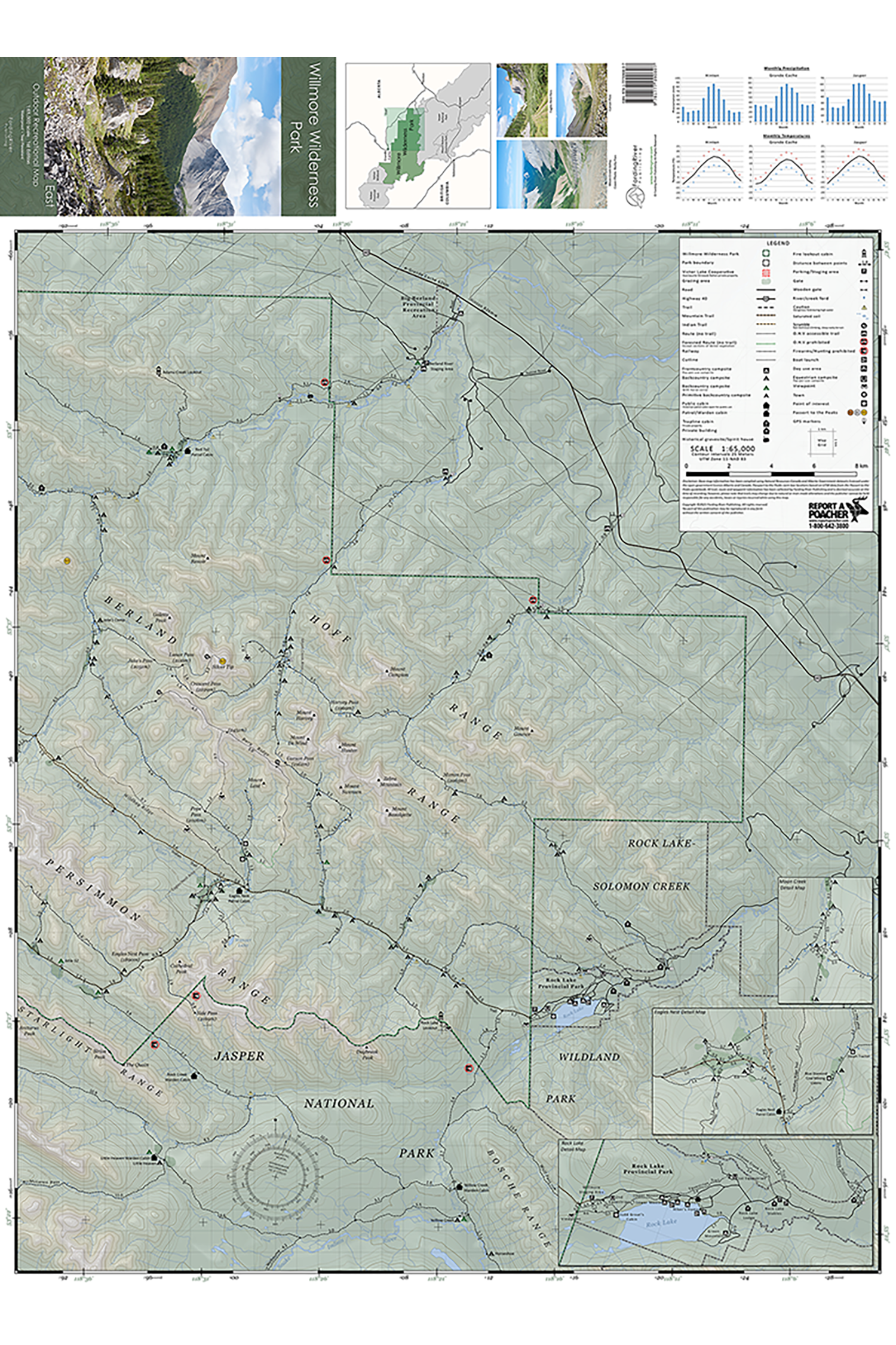
Willmore Wilderness Park East
The first detailed map for the eastern half of Willmore Wilderness Park with more than 600km of established trails and routes surveyed, making it the most accurate and comprehensive map to date.
Map Includes:
585km of established trails
57km of cross-country routes
Over 100 campsites
Horse corrals and grazing areas
Historical buildings and grave sites
Passport to the Peaks cairn box locations
Ford Locations
GPS coordinates for unmarked trails and junctions
Precipitation and temperature charts
3 details insert maps for Rock Lake, Eagles Nest and Moon Creek
Park access trails from Cowlick Creek, Berland River, Little Berland River, Rock Lake and Jasper National Park
Product Details:
Scale: 1:65,000
Contour Interval: 25m
Size (folded): 9.5” x 4.5” (24.1cm x 11.4cm)
Size (flat): 35” x 25.5” (88.9cm x 64.8cm)
Weight: 44g
Waterproof and tear-resistant synthetic paper
Shipping:
Product ships via Canada Post letter mail
Delivery times: 2-4 business days within Canada & 4-7 business days within the U.S.A